SkyMul Digital Twin QC
SkyMul · Inspection · Shipping
Last updated: 2026-03
Summary
The SkyMul Digital Twin QC is a drone-based site inspection system that captures aerial imagery and LiDAR data to generate digital replicas for quality control on concrete and tilt-up construction. It covers three subtasks within the QC job: 3D scanning and point cloud capture, drone survey and aerial documentation, and drawing-to-panel comparison for error detection. The product is listed as shipping with zero confirmed deployments; all documented evidence is vendor-sourced.
How it works on your site
3D Scanning and Point Cloud Capture
Automated drones fly the site and capture high-resolution imagery and LiDAR data, which is processed into a digital replica. The system compares sequential scans to track daily changes and flag discrepancies over time.
Drone Survey and Aerial Documentation
The system uses a drone-in-a-box configuration for persistent on-site flights rather than manual drone launches. SkyMul states it has obtained regulatory approvals for constrained airspace operations, though specific waivers are undocumented.
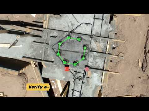
BIM-to-Field Comparison (Scan-vs-BIM)
The system overlays 2D construction drawings against scanned as-built panels to catch alignment errors before concrete pour. No BIM, IFC, or Revit integration has been documented across any source; the comparison appears limited to 2D drawing overlays.