
Image: Flyability

Elios 3

Flyability

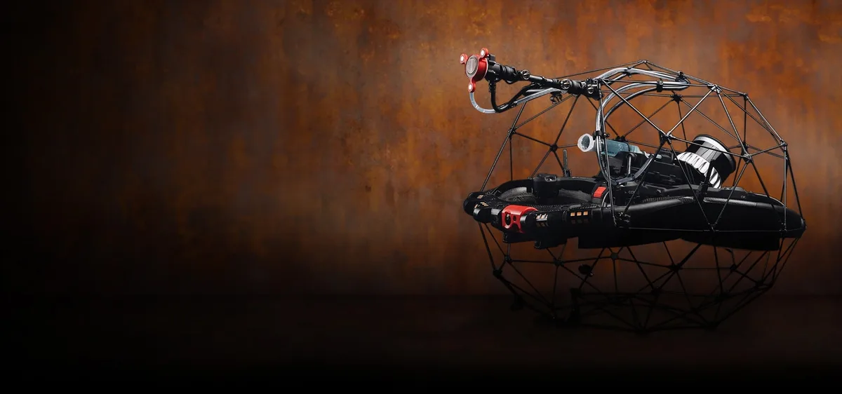
Caged inspection drone that flies inside confined spaces without GPS and maps them with LiDAR

14
Deployments
7
Companies that ran it

How it works on your site

The Elios 3 is a caged, pilot-flown inspection drone from Flyability that flies inside confined, GPS-denied spaces such as shafts, sewers, tanks and voids, localising with FlyAware LiDAR and computer-vision SLAM. It records 4K video and LiDAR point clouds and exports .las and .e57 files that surveyors carry through to Revit. On a train-station roof for NS Stations, night flights replaced conventional access that needed three rail line closures and 13 weeks of planning lead time, according to a Flyability case study. The Elios 3 launched in May 2022 and is shipping.

Field outcomes

1 of 5
  1. Elios 3Image: Flyability

    Academy Geomatics surveyed a buried 60 m sewer with Elios 3 in half a day, with two operators above ground and nobody entering the manholes.

    Sewer survey beneath a footbridge marked for potential reconstruction, UK

    Elios 3Academy Geomatics

  2. Elios 3Image: Flyability

    Tetra Tech Netherlands flew an Elios 3 drone up a burned staircase into the fire-damaged attic of a 1930s landmark building in the Netherlands, giving municipal authorities 4K and LiDAR data to plan restoration.

    Fire-damaged 1930s landmark attic, pre-restoration assessment, Netherlands

    Elios 3Tetra Tech Netherlands

  3. Elios 3Image: Flyability

    A cement plant in France used the Elios 3 to scan its entire site for a scan-to-BIM digital twin, with in-house drone pilots gathering all the necessary laser scans in 1 day of flying.

    Cement plant digital twin, France

    Elios 3

  4. Elios 3Image: Flyability

    Gedeon GRC flew the Elios 3 drone with Survey LiDAR inside eight vertical shafts at Brooklyn Army Terminal, working with Suffolk Construction and NYCEDC, to produce point clouds for existing-conditions modeling and construction planning.

    Brooklyn Army Terminal: shaft scans, USA

    Elios 3Gedeon GRC

  5. Elios 3Image: Flyability

    Plowman Craven piloted the Elios 3 drone with LiDAR to survey hazardous underground and elevated Victorian voids at Ballymore's Bishopsgate Goodsyard regeneration in Shoreditch, London, generating point clouds for the project's BIM model.

    Bishopsgate Goodsyard regeneration, UK

    Elios 3Plowman Craven

Will it work on your site

Site Preparation
Access opening only; no external lightingNight flights on rail-station and sewer jobs
Power Source
Swappable battery or 50 m tetherLight Package ships 3 batteries and 2 chargers
Connectivity Requirements
Radio link to controller and tabletUp to 500 m line of sight (service-provider figure)
Control Interface
Remote controller plus tablet running InspectorTraining Simulator included; Inspector 5 for on-site QC
BIM/CAD Requirements
File export: .las or .e57 to RevitOr Recap, then Civil 3D, then Revit
Travel Speed
About 5 m/s (300 m/min)Service-provider figure; not on OEM pages

As the maker states it.

Want more information?

We send your request to Flyability, the maker.

Something wrong? How corrections work

Make this robot? Claim the profile

Leave an email and we'll get in touch about maintaining this profile.